

3D Geo Globe

وصف لـ3D Geo Globe
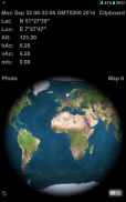
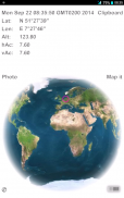
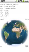
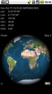
This GPS tool shows an accurate NASA longitude latitude map projected onto a 3D globe of the earth. A small pink indicator circle pinpoints your current geo-location based on received GIS GPS data or on a triangular wi-fi calculation. Save a photo for mail or for album geo tagging.
User Manual and Features:
* tap the clock to toggle GMT & UTC displayed time and hidden.
* tap Lon & Lat (Latitude or Longitude) to display the pink indicator in the center. Tap again to switch conversion from Decimal Degree to DMS (Degrees, Minutes, Seconds).
Note: choosing this mode while flying transcontinental will show the earth rotating under the indicator.
* swipe to the east & west for a spinning globe, tap the globe to hold the current rotation.
* tap Alt (altitude) to switch from meter to feet (see feet ' character) or hidden. Same behavior for tapping though vAc (vertical accuracy) and hAc (horizontal accuracy) combined.
* tap on m/s (meter per second) speed will switch to kmh (kilometer per hour) and tap again to fps (feet per second) and to mph (miles per hour) and kn (nautical knots) and to blank
* The 'map it' button takes you to the respective google map in your browser or Maps app
* All of your settings will be saved automatically
Tip: The blank (hidden) options can be used for manipulation of the captured photos. Which info would you like to reveal?
Tap on the miniature © in the corner to find out about the author ... tap again to hide. All other buttons are suspended during this display.
The ©, 'map it' and 'photo' and switch background color button will not be captured by the photo option.
After clicking 'photo' you'll get a 'saved' or 'error' prompt, click again to activate the photo option anew.
Turn on GPS for best results!
Adobe AIR android 2.2 up
هذه الأداة GPS يظهر خط الطول خط العرض ناسا دقيقة الخريطة المسقطة على العالم 3D الأرض. A صغيرة دائرة المؤشر الوردي يبرز تلقت الحالي الجغرافية GIS الموقع بناء على بيانات GPS أو على حساب واي فاي الثلاثي حفظ صورة للبريد أو العلامات الجغرافية الألبوم.
دليل المستخدم والميزات:
* الاستفادة من ساعة للتبديل وGMT UTC الوقت المعروض منها وما بطن.
* الحنفية خط الطول وخطوط الطول (خط العرض خط الطول أو) لعرض مؤشر الوردي في المركز. انقر مرة أخرى للتبديل التحويل من عشري إلى DMS درجة (درجة، دقيقة، ثانية).
ملاحظة: اختيار هذا الوضع في حين تحلق عابرة للقارات سوف تظهر الأرض الدورية تحت المؤشر.
* انتقاد إلى الشرق والغرب لكرة الغزل، اضغط على العالم لعقد التناوب الحالية.
* الحنفية Alt (في الارتفاع) للتبديل من متر إلى متر (انظر حرف قدم ') أو المخفية. نفس السلوك للتنصت على الرغم من بطالة (دقة العمودي) وHAC (دقة أفقية) مجتمعة.
* سوف استفادة على م / ث (متر في الثانية) سرعة التحول إلى KMH (كيلو متر في الساعة) وانقر مرة أخرى إطارا في الثانية (قدم في الثانية) وإلى ميل في الساعة (ميلا في الساعة) وكيلونيوتن (عقدة بحرية) وفارغة إلى
* زر "خريطة انه ينقلك إلى خرائط Google كل منها في المتصفح أو تطبيق الخرائط
* سيتم حفظ كافة الإعدادات تلقائيا
نصيحة: يمكن استخدام فارغة (مخفي) خيارات للتلاعب من الصور التي تم التقاطها. والتي ترغب في معلومات تكشف؟
اضغط على مصغر © في الزاوية لمعرفة نبذة عن الكاتب ... انقر مرة أخرى لإخفاء. وعلقت جميع الأزرار الأخرى خلال هذا العرض.
و©، "خريطة انها ولن 'الصورة' زر التبديل ولون الخلفية يمكن التقاط الصور بواسطة الخيار.
بعد النقر على 'الصورة' ستحصل على 'إنقاذ' أو 'خطأ' الأوامر، ثم اضغط ثانية لتفعيل خيار الصورة من جديد.
تشغيل GPS للحصول على أفضل النتائج!
أدوبي AIR 2.2 الروبوت حتى


